ONLY IN MILL VALLEY · A HISTORY
MILL
VALLEY
The mill, the mountain railway, and the streets I still walk. The story of my hometown, the way I tell it.

Beth Brody
Mill Valley native. Selling here since 1978.
A NOTE BEFORE WE START
I was born and raised here by my family's choice in 1956. The decision to stay is entirely mine.
BETH BRODY

The Tamalpais Swim Club, 1970: the Mill Valley childhood I grew up inside. Swim meets, the plaza, the mountain out every window.
When you've walked these streets your whole life, the history stops being trivia. It's the reason the lots in Blithedale Canyon are shaped the way they are, why the steps behind Old Mill Park go where they go, why the depot in the middle of town sells books instead of train tickets. This is the short version of that story, the one I tell clients on the drive between showings.
Every date here comes from the record. Where memory fills the gaps, I'll say so.
CONTENTSEIGHT CHAPTERS
The story, chapter by chapter
01 · BEFORE THE MILLTO 1834
A valley of redwoods, and the people who knew it first
Long before there was a mill, there were the Coast Miwok, in Marin for roughly six thousand years, with fourteen known village sites in the Mill Valley area alone. The valley they knew was old-growth redwood, creeks, and marsh running down to Richardson Bay.
In 1834, an Irish immigrant named John Reed received the Rancho Corte Madera del Presidio land grant and built a sawmill on Cascade Creek to cut lumber for the Presidio. The mill gave the valley its name. Its timbers still stand in Old Mill Park, a short walk from the library.
Once the slopes were logged, the land changed hands, was divided, and waited for what came next: summer people.
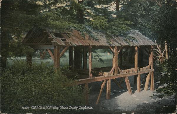
"Old Mill at Mill Valley, Marin County, California." John Reed's sawmill timbers, still standing in the park that takes their name.
02 · THE SUMMER RESORT ERA1873 TO 1889
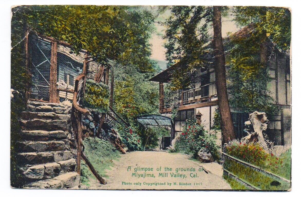
"A glimpse of the grounds of Miyajima, Mill Valley," 1907. One of the canyon resorts where San Franciscans came for the summer and stayed for good.
The 320 "lost" acres that became Blithedale
In 1873, San Francisco physician Dr. John Cushing found 320 unclaimed acres between the Reed and Richardson land grants and secured them under the Homestead Act. He built a sanitarium in the quiet canyon; after his death, his family turned it into the Blithedale Hotel.
Other resorts followed: the Abbey, the Eastland, the Redwood Lodge. San Franciscans came for the summer to fish, hike, and ride. Some stopped going home, commuting instead by ferry and rail. The pattern of this town, city people falling for a canyon and refusing to leave, is older than the town itself.
In 1889 the Tamalpais Land & Water Co. was formed to turn the valley into a proper town, hiring engineer Michael O'Shaughnessy to lay out the roads, paths, and step systems we still use as shortcuts today.
03 · THE DAY THE TOWN WAS SOLDMAY 31, 1890
3,000
people came by ferry and rail to the land auction held near Reed's crumbling sawmill in Old Mill Park.
200+
acres sold in a single day, valued at $300,000 in 1890 dollars.
1900
the year residents voted to incorporate, pushing out the land company and taking the town for themselves.
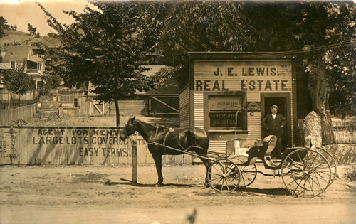
The J.E. Lewis Real Estate office: "large lots covered with easy terms." The town's first real estate agents set up shop almost before the town existed.
The day the town was sold
For a while the place answered to two names: "Eastland," after the developer, and "Mill Valley," after the mill. The post office settled the argument in 1904. The mill won.
04 · THE CROOKEDEST RAILROAD IN THE WORLD1896 TO 1930
8.19 miles, 281 curves, 22 trestles, from the depot to the top of Mt. Tam
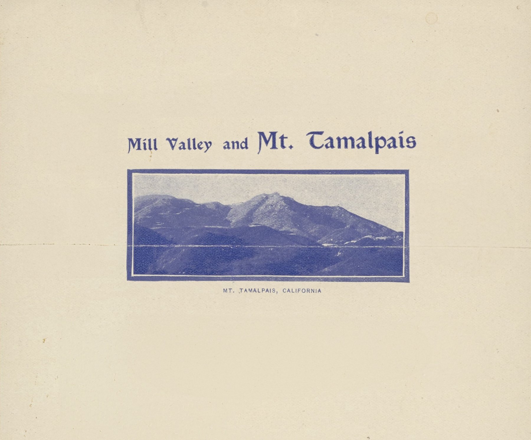
In 1896, crews of about 200 men carved a railbed up the mountain by hand in six months. The Mill Valley & Mt. Tamalpais Scenic Railway ran from the town center to the summit, where the Tavern of Tamalpais served dinner with a view of the entire Bay. Thomas Edison's film crew came to shoot it in 1898. A branch line reached Redwood Canyon in 1907, the year before it became Muir Woods National Monument.
The signature move was the trip down: engineless gravity cars, coasting from the summit into town with nothing but a brakeman between you and the curves.
The Great Fire of July 1929 burned the mountain and 117 homes, and the town was spared only by a change in the wind. That October the railway ran for the last time; the tracks came out in 1930. The old right-of-way is now the Railroad Grade fire road. Ride it and you're on the roadbed.
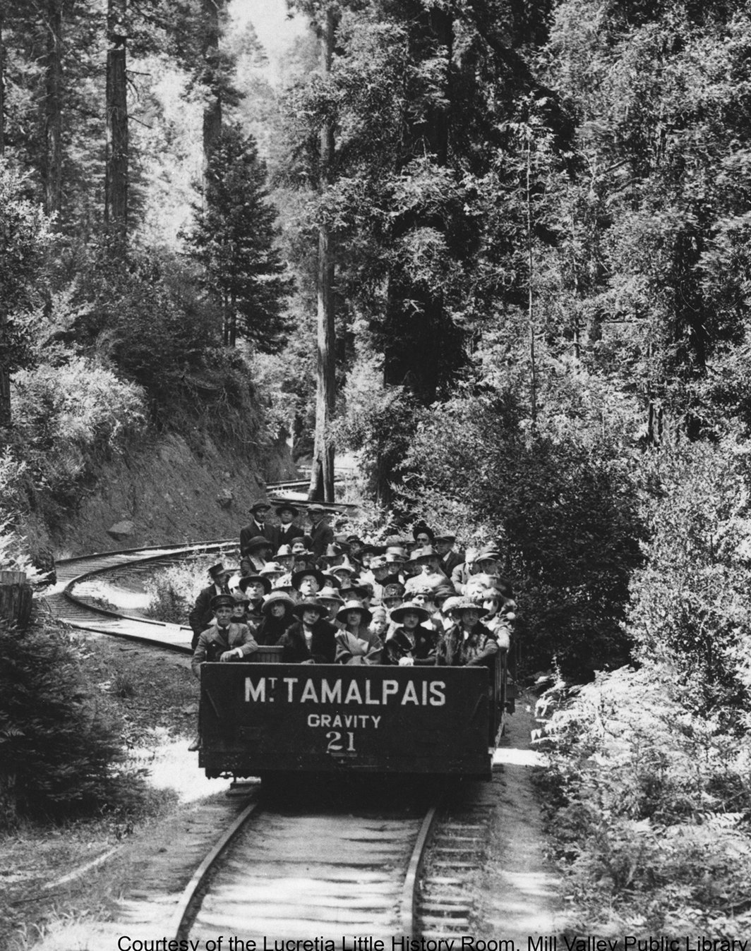
Gravity car No. 21, loaded with hatted passengers, coasting down through the redwoods. No engine, just a brakeman and the grade. Courtesy of the Lucretia Little History Room, Mill Valley Public Library.
"The pattern never changed. People come for a weekend, and then they spend the rest of their lives explaining why they never left."
BETH BRODY
05 · THE TOWN GROWS UP1900 TO 1929
Quake refugees, trail runners, and a theater on Throckmorton
After the 1906 earthquake, San Franciscans fled here, and most never left. The population passed 1,000 that year. Tam High and the first city hall arrived in 1908, the Carnegie library in 1910.
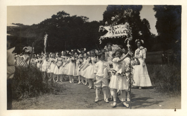
A children's parade under the "Mill Valley" banner, early 1900s. The town threw itself festivals from the start.
06 · THE HOUSESA FIELD GUIDE
You can read the whole history from the sidewalk
Mill Valley never had a single architecture. It had waves, and because almost nothing here was built on a grid, the waves sit side by side on the same lane. A resort-era cottage shares a fence line with a brown shingle from the quake boom and a glass box from the sixties.
The constant is the material. Redwood built the town twice: first as lumber shipped to San Francisco, then as the shingles, board-and-batten, and post-and-beam frames of the houses that came after.
MY RULE
"Don't fall for staging; fall for structure."
In a town of century-old cottages, the bones matter more than the paint. I walk every foundation before I talk price.
1890s
The summer cottage
The resort era's first houses: simple redwood board-and-batten and shingle cabins, built for August and winterized later. Many of today's homes still have one inside them.
Spot it: low ceilings in the oldest rooms, additions stepping downhill, a front door facing a footpath instead of the street.
1892
The Victorian moment
The auction crowd built proper houses fast. Developer Joseph Eastland's summer home "Burlwood" (1892) still stands on Throckmorton, the first house in town with electricity. Local builder Harvey Klyce shaped many early homes and public buildings.
Spot it: fish-scale and diamond shingle patterns, bay windows, stately survivors near Sycamore and Tamalpais Park.
1900s
Brown shingle & Craftsman
After the 1906 quake, refugees built year-round houses in the Bay Region manner: unpainted redwood shingle, deep eaves, big porches. Bernard Maybeck's Outdoor Art Club (1904) is the town's landmark of the style; Homestead Valley filled with Craftsman and Colonial Revival homes.
Spot it: shingles gone silver-brown, exposed rafter tails, clinker brick chimneys.
1930s
Depression-era civic
The WPA and CCC gave the town its public architecture: City Hall finished in 1937, the Mead Theater at Tam High, and the stone amphitheater seating at the Mountain Theater.
Spot it: honest stone and stucco, hand-set rockwork that has outlasted everything built cheaper since.
1940s to 60s
Post-war cottage to post-and-beam
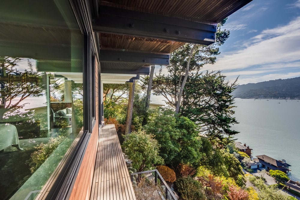
The flats filled with modest post-war cottages, while the steep lots, the ones the first builders skipped, got glass-and-redwood post-and-beam houses standing on stilts, chasing the view.
Spot it: flat or low-pitched roofs, walls of glass toward Tam or the bay, carports instead of garages.
Today
The remodel era
Most "new" houses here are old ones reworked: a cottage opened up behind its original facade, a Victorian with a modern kitchen. The lot lines and lanes are still O'Shaughnessy's 1890 plan.
Spot it: a 19th-century face with 21st-century glass at the back. Check the assessor's date, then check the framing.
07 · THE NEIGHBORHOODS, AND WHERE THEY CAME FROMMILL VALLEY · 94941
Every neighborhood here is a chapter of the same story
My shorthand for each one, with the history underneath it.
RESORT ERA · 1870S
Blithedale Canyon
Cushing's "lost" 320 acres and the Blithedale Hotel made this the original summer colony. Railway investors and directors bought multiple lots here; it was the prestige address from day one.
My note: Creekside lots under full canopy. Check the sun exposure in December, not June.
THE NAMESAKE · 1834
Old Mill Park
Reed's sawmill stood here, and the 1890 auction was held beside its ruins. The public steps and lanes threading the hillside are O'Shaughnessy's original pedestrian plan.
My note: The Dipsea steps start here. Houses on the lanes trade quietly; this is off-market country.
RAILWAY TERMINUS · 1896
Downtown & Lytton Square
The mountain railway began at the depot on Throckmorton. The square is named for Lytton Barber, the town's first WWI casualty. The depot is now the bookstore and café.
My note: The town still runs on depot coffee. Everything here is walk-to, and priced like it.
STREETCAR FLATS · 1900S
Sycamore & Tamalpais Park
The level land east of downtown filled in after incorporation: Victorians first, then post-war cottages. Tamalpais Park School's class photos date to 1910.
My note: Flat yards add value. Always. This is where you find them.
THROCKMORTON'S RANCH · 1850S
Homestead Valley
Named for Samuel Throckmorton's ranch "The Homestead." Development began in the early 1900s; today its land trust keeps whole hillsides open, with the Dipsea trail on its northern edge.
My note: Unincorporated, so county services, not city. Buyers are surprised every time.
DAIRY LANDS · 1860S
Tam Valley & Almonte
Portuguese settlers, most from the Azores, ran dairies on leased Throckmorton land. Ranch "B" near the Tennessee Valley trailhead is one of the last dairy buildings standing.
My note: Shortest commute in town, best trail access, and the Tam Junction merge is a character-building sport.
BAYFRONT PENINSULA · 1940S
Strawberry
A peninsula reaching into Richardson Bay, named for the wild berries that once grew here. Long grazing land, it filled in after WWII, with the Seminary building and the recreation district anchoring a quieter, water-facing enclave.
My note: The bay light and the lagoon views are real. Check the flood zone and the HOA before you fall for either.
BAYFRONT FLATS · 1960S
Enchanted Knolls & Shelter Bay
Just west of Highway 101, this cluster (Enchanted Knolls, Shelter Ridge, and the waterfront condos of Shelter Bay) was built out on the sunny land nearest the freeway, some of it on filled marsh reaching toward Pickleweed Inlet.
My note: The easiest commute and the sunniest weather in town. Watch for water-and-marsh views, and confirm the parcel isn't on old fill.
REDWOOD RETREAT · 1900S
Cascade Canyon
The canyon above Old Mill Park, following Cascade Creek to its waterfall. Reed's original mill drew its power from this water; later it became a wooded retreat of cabins tucked under second-growth redwoods along Cascade Drive.
My note: Filtered redwood light and creek-sound therapy, but check winter sun and the creek setbacks before you commit.
08 · STILL HERETHIS WEEKEND
Where to touch the history this weekend
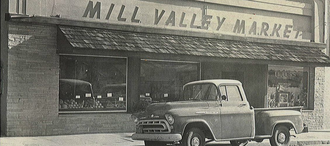
Mill Valley Market, family-run since 1929 and still on Corte Madera Avenue. The truck dates the photo; the store hasn't moved.
THE LAY OF THE LAND
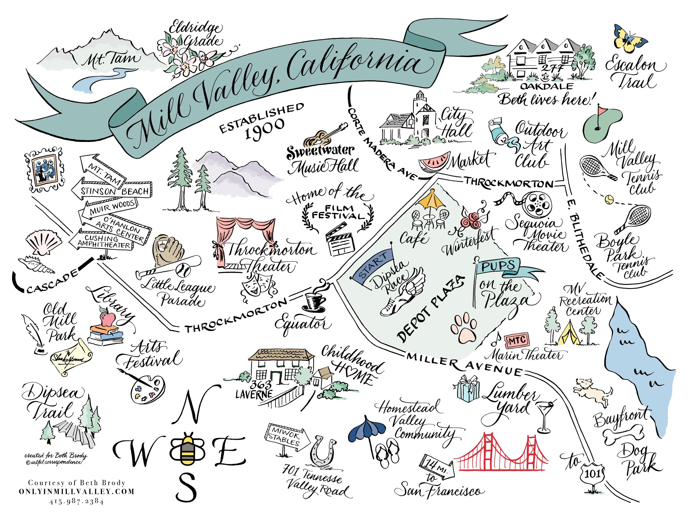
O'Shaughnessy's 1890 street plan is the map you still navigate
The winding roads, the pedestrian lanes, the public steps: they were drawn before the first houses went up, following the creeks and contours instead of a grid. It's why no two lots here are alike, and why I walk every property before I talk price.
Three generations. One town. One team.
If a piece of this history has your name on it, a cottage in the canyon or a Victorian near Sycamore Park, I probably know the block. I may know the house.
Beth Brody · Realtor® · DRE 00657511
415.987.2384 · [email protected]
250 E Blithedale Avenue, Mill Valley, CA 94941
onlyinmillvalley.com · @onlyinmillvalley
Rooted in Mill Valley. Driven by Expertise.
Sources: Mill Valley Historical Society; Mill Valley Public Library, Lucretia Little History Room; Friends of Mt. Tam. Archival photos courtesy of the Mill Valley Public Library, used with permission.